You can sponsor this page

Anthias helenensis Katayama & Amaoka, 1986

Add your observation in Fish Watcher
Native range | All suitable habitat | Point map | Year 2050
This map was computer-generated and has not yet been reviewed.
Anthias helenensis   AquaMaps   Data sources: GBIF OBIS
Upload your photos and videos
Pictures | Google image
Image of Anthias helenensis
Anthias helenensis
Picture by Beard, A.

Classification / Names Κοινά ονόματα | Συνώνυμα | Catalog of Fishes(Γένος, Είδη) | ITIS | CoL | WoRMS | Cloffa

> Perciformes/Serranoidei (Groupers) > Anthiadidae (Fairy basslets or Streamer basses)
Etymology: Anthias: Greek, anthias, oy = a fish (Sparus aurata) (Ref. 45335).

Environment: milieu / climate zone / depth range / distribution range Οικολογία

Θαλασσινό(ά) βαθύβιο(ς); εύρος βάθους 163 - 460 m (Ref. 11656). Deep-water

Κατανομή Χώρες | Περιοχές FAO | Οικοσυστήματα | Παρουσίες | Point map | Εισαγωγές | Faunafri

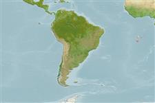
Southeast Atlantic: north of St. Helena.

Μέγεθος / Βάρος / Age

Maturity: Lm ?  range ? - ? cm
Max length : 17.9 cm SL αρσενικό/απροσδιόριστο; (Ref. 11656)

Βιολογία     Γλωσσάρι (π.χ. epibenthic)

Life cycle and mating behavior Maturities | Αναπαραγωγή | Spawnings | Egg(s) | Fecundities | Προνύμφες

Main reference Upload your references | Αναφορές | Συντονιστής | Συνεργάτες

Katayama, M. and K. Amaoka, 1986. Two new anthiine fishes from the eastern tropical Atlantic. Jap. J. Ichthyol. 33(3):213-222. (Ref. 11656)

IUCN Red List Status (Ref. 130435)

Can't connect to MySQL database (fbapp). Errorcode: Too many connections